The Kaipara Harbour loop — a day’s ride from Pahi.
Two hundred and twenty kilometres around the largest harbour in the southern hemisphere. Sealed twisties, gravel on the Pouto Peninsula, the Kauri Museum, the lighthouse at the end. A Northland day ride from Pahi.
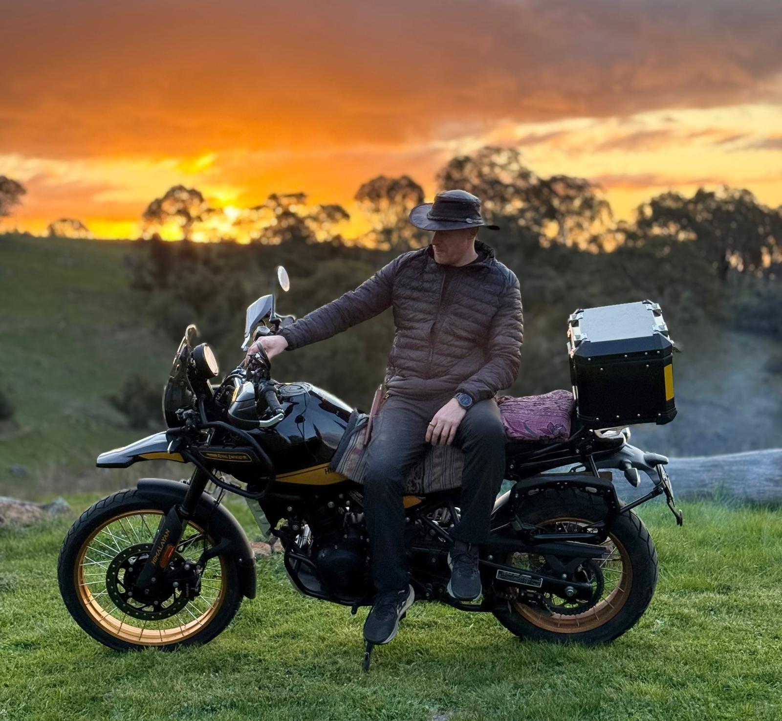
Late afternoon on the road home from Te Kopuru. The harbour is the silver line in the middle distance; the road is one of the great underrated rides of Northland.
The Kaipara Harbour is the largest harbour in the southern hemisphere. It is also one of the least known of the great New Zealand rides. The harbour is bigger than the Auckland-Waitemata; it has eight hundred kilometres of shoreline; it has had pre-European Māori settlement, gold-rush schooner traffic, kauri-logging boom and bust, and the slow modern quietness of a place tourism never quite found. From Pahi, where Hunter lives, you can ride a 220-kilometre loop that takes in the harbour’s southern shore, the great Kauri Museum at Matakohe, the old kauri country between Maungaturoto and Dargaville, and the Pouto Peninsula lighthouse where the harbour meets the Tasman Sea. It is a comfortable half-day or an unhurried full day. It is what I do most weeks the weather allows.
I’m writing this in May. Autumn light. The harbour has been gunmetal for three weeks straight and it is still beautiful. The loop, ridden today, took five hours of on-bike time and another two of stopping. This is the version with numbers, fuel stops, and the bits of the road where you should pay attention.
The short version
From Pahi: north on Pahi Road to State Highway 12, east to Maungaturoto, southwest through Paparoa to Matakohe, west to Ruawai, north to Dargaville, south to Te Kopuru, then southwest down the Pouto Peninsula to the lighthouse and back. Total: about 220 km of mixed seal and gravel. Fuel: top up at Maungaturoto outbound, Dargaville on the return. A 17-litre Himalayan 450 tank does the whole loop on a single fill with reserve.
Pahi to Matakohe — the kauri country
Pahi sits at the end of a narrow finger of land pointing south into the Pahi River, which feeds the Otamatea Channel of the Kaipara. The first kilometre of every ride is the same gravel road from the cottage up to State Highway 12. After a week of dry, the gravel is firm and brown. After a day of rain it becomes the kind of clay that the Mitas Dakars were made for. Both surfaces are part of the deal.
State Highway 12 between Maungaturoto and Paparoa is the section that earns the loop its character. The road runs through farmland that was, a hundred and twenty years ago, kauri forest the height of cathedral spires. The trees were felled and shipped to build Auckland, San Francisco, Sydney. What’s left is rolling pasture with the occasional surviving giant tree on a fence line, and the road that still wraps the contours of the old forest floor. It is a road for riding at the pace of the country, not the pace of the GPS’s ETA.
At Matakohe, the Kauri Museum is one of the great small museums of New Zealand. I have stopped there maybe a dozen times now and not always gone in. Today I went in. The model schooners alone are worth the twenty-five dollar entry; the gum room is what stays with you. I left after an hour and rode west.
Ruawai to Dargaville — the broken edge of the harbour
Past Matakohe the road runs through Ruawai, which is a town that mostly farms kumara and rice in the rich tidal flats of the Northern Wairoa River. The road from Ruawai to Dargaville is fifteen kilometres of fast, sweeping tarmac that runs along the riverbank. The river is the Wairoa, draining the country south into the Kaipara. You can stop on a bend and look at it. I usually do.
Dargaville is the largest town on the loop. About 4,500 people. The main street is a working street — farm-supply shops, a bakery (Ben’s on Victoria Street has a meat pie I would ride for), the Kauri Hotel, a Mitre 10. Fuel is cheapest at the BP at the south end of town. I top up here before the long southward leg.
The Pouto Peninsula — the gravel and the lighthouse
South of Dargaville the road becomes Te Kopuru Road, which runs straight south down the spine of the Pouto Peninsula. Te Kopuru itself is a small fishing village twenty-five kilometres south — the last sealed point. From Te Kopuru, the road is gravel for the next twenty kilometres or so, ending at the small settlement at Pouto Point, where the Kaipara Harbour empties into the Tasman Sea over a sandbar so notorious that more than 110 ships have wrecked on it.
The gravel is well-maintained Northland gravel — firm, with patches of soft shell and corrugation in spots. On a 90/90-21 Mitas Dakar front it is fast; on a sport-tourer it is honest work. I run 65-75 km/h the whole way and arrive cleaner than the bike does. On a wet day the surface goes clay and the speed drops to 50; the corners get sticky.
The Pouto lighthouse is at the end of a 4-km walking track from the road end. You cannot ride to the lighthouse. The walk is across sand dunes and through marram grass. Forty minutes one way. Worth it. The lighthouse is wooden, white, and from 1884 — one of the oldest in New Zealand. The view back across the harbour is the kind of view that makes you think about why people came here in the first place.
The Pouto sandbar has wrecked more than 110 ships. Standing at the lighthouse, you can see why.
The way home
Back up the gravel to Te Kopuru, then north again to Dargaville, east on State Highway 14 over to Whatitiri and Maungatapere, and finally back to Pahi via the same SH12 route in reverse. The eastern variant is faster than retracing through Matakohe. The light at this hour — mid-afternoon to late afternoon — is the Kaipara at its best. The harbour silvers as the sun lowers. Hunter’s shadow gets long across the gravel shoulder.
I was home by six. The cottage was cold; the kettle was on within ten minutes. The Kaipara loop is a ride you can do every week of the year and never quite ride the same loop twice. The harbour has weather. The weather has light. The light makes the country.
The route, step by step
Pahi → State Highway 12 north: 8 km, gravel + sealed.
SH12 east to Maungaturoto: 12 km, sealed.
Maungaturoto → Paparoa → Matakohe: 32 km, sealed, twisty.
Matakohe → Ruawai → Dargaville: 35 km, sealed, fast.
Dargaville → Te Kopuru: 25 km, sealed.
Te Kopuru → Pouto Point: 22 km, gravel, well-maintained.
Walk from road end to lighthouse: 4 km each way.
Return Pouto → Te Kopuru → Dargaville: 47 km.
Dargaville → Whatitiri → Maungatapere → SH12 east → Pahi: 95 km, sealed.
Total ride distance: ~220 km on the bike, plus the 8-km lighthouse walk.
What to know before you go
The Pouto gravel after rain. Northland clay, when wet, is its own surface. Any 250cc-and-up adventure bike with dual-sport tyres handles it; a road-only bike will struggle. If you have not ridden clay before, treat it like ice in the wet, and keep speed down to 50 km/h.
The harbour wind. The Kaipara has its own weather. The forecast for Dargaville is often wrong by one full step (rain when it predicted dry, or the other way around). Pack wet-weather kit even on a clear morning.
Tide and the lighthouse walk. The walk to Pouto lighthouse crosses dunes that, at high tide with a strong sea, can be uncomfortable. Most days, fine. Check tide charts if you are doing it close to high water; the walk is much better an hour either side of low.
The Kauri Museum. Allow two hours minimum if you go in. They open at 9, close at 4 in winter and 5 in summer. The carpark fits motorcycles. Parking is free.
If you want to go further
The natural extension is to add the Whangarei northern tip on the eastern leg — another 80 kilometres of mixed road through the Whangarei Heads with a possible camp at Urquharts Bay if you want a two-day version of the loop. The bigger extension is to combine the Kaipara loop with the Cape Reinga route into a four-day Northland tour.
What’s next
The Coromandel Peninsula route is the next Northland- adjacent guide I’m writing — the run that picks up where the Coromandel drop left off. It’s a longer ride further south but the same character of road.
In the meantime: if you have a small adventure bike and a free Saturday in Northland, the Kaipara loop is the right answer. Two hundred and twenty kilometres, one harbour, one lighthouse, one museum, no tourists. The country earns the time you give it.
Get the next one
Twice a month. Photographs, a reflection, where I’m headed next.