Pahi to Cape Reinga — riding the length of the North Island.
Six hundred and forty kilometres of Northland on a small adventure bike. The route, the camps, the fuel stops, and the day Hunter and I ran out of country.
Northland from a low ridge somewhere past Kawakawa. The cloud was moving north faster than I was; by Kaitaia it was rain.
The thing about riding to Cape Reinga is that you can feel the country narrowing under you as you go. From Pahi the road runs through farmland, then forest, then farmland again, the peninsula thinning, the harbours folding closer, and somewhere past Kaitaia the land becomes a finger of dunes pointing into the Tasman Sea and the Pacific Ocean meeting in a long white seam off the rocks. That seam is what you go to see. It is what the Māori mean by Te Rēinga — the leaping place — where the spirits of the dead leave Aotearoa for Hawaiki. Standing at the lighthouse with a small bike parked behind you and the wind taking the seagulls sideways, the place earns its name.
I rode it in late March, two weeks after Hunter arrived in New Zealand on the carnet. The plan was a two-day loop — Pahi to a camp near the Cape on day one, Cape lighthouse to home on day two — on the assumption that doing it inside one day was technically possible and emotionally wrong. The country deserved an overnight. So did I.
The short version
Pahi to Cape Reinga is about 320 km one-way via the quickest route (State Highway 12 to Kaitaia, State Highway 1F to the Cape), or about 380 km via the northeast (over to State Highway 1 north of Whangarei, then SH1 the whole way). Two days of riding handles it comfortably with a camp near the top. You need no special permits or paperwork; the road is sealed all the way to the Cape carpark. A Royal Enfield Himalayan 450, or any 250cc-and-up adventure bike, eats it. So does a sport-tourer; this is not a technical route. What it is, is long, exposed, and worth the time.
Day one — Pahi to Tapotupotu Bay
I left Pahi at six-thirty on a clear autumn morning, the inlet still misty, the kettle still warm on the bench. The auxiliary lights were still on for the first half-hour — the OEM beam is fine, but on a Northland back road before dawn the extra light off the verge is what picks up the wallabies. The first leg is the most beautiful: Pahi to Dargaville on State Highway 12, the road wrapping the southern shore of the Kaipara Harbour through farmland that has been farmland for a hundred and fifty years. On the long sealed straight north of Dargaville I locked the cruise at 95 and let the right wrist rest. The light at that hour comes from low behind you and turns the water silver. I stopped at the Matakohe Kauri Museum's carpark for ten minutes — the museum opens at nine and I was ahead of it — and stood with the bike off, listening to a tui in the macrocarpa. Adventure motorcycling has these moments. They are why you do it.
From Dargaville you have a choice. State Highway 12 continues north through Waipoua Forest, which is where the Kauri trees live. Tane Mahuta — the largest known kauri, two thousand years old, fifty-one metres tall — is a five-minute walk off the road. I had not been before. I went. The walk takes you through ferns under the canopy and the noise of the highway disappears within twenty paces. Tane Mahuta is a tree you can hear breathing if you stand quietly for long enough. I stood quietly for long enough.
North of Waipoua the road is mostly empty. Through Opononi, Omapere, around the Hokianga Harbour, then east to Kaikohe and finally Kaitaia. Kaitaia is the last proper town before the Cape and the right place to top up fuel, water, and food. I stopped at the roundabout BP, filled the tank, ate a service-station sandwich, and rode the last 100 km to camp.
Tapotupotu Bay DOC campsite is twenty kilometres south of the Cape itself. It sits in a valley behind a small white-sand beach where two streams meet the sea. The campsite is basic — long-drop toilets, no showers, cold tap water from a tank, no power — and is one of the most beautiful places I have camped. Twenty Australian dollars a night. Cash only. I pitched the tent in the lee of a flax bush, made a fire on the beach with Hunter parked just behind, and watched the last of the afternoon light go gold over the cliffs. The closest other camper was three hundred metres away, an older couple from Wellington in a hired van. We waved.
Day two — Cape Reinga and the run home
I rode to the Cape lighthouse at first light. The twenty kilometres of road from Tapotupotu to the carpark winds along a ridge with the Pacific on the right and the Tasman on the left and very little other vehicle traffic at six in the morning. The lighthouse is at the end of a 700-metre walking path from the carpark; you cannot ride the bike to the light itself. Park, walk, stand. The wind takes your hat. The seagulls do whatever the seagulls do. The two oceans meet in a churned line of white about three hundred metres offshore that is, on the right day, visible to the eye as a separate seam between two different colours of water. On the wrong day it is just sea.
I sat for half an hour. There were maybe three other people there. None of us spoke. There was nothing to say.
The run home is the same route in reverse, but with a different feeling. Going north you are running out of country; going south you are running back into it. I took the eastern variation on day two for variety: down State Highway 1 to Whangarei, then State Highway 14 across to Dargaville, then State Highway 12 home. The east coast is faster (more tarmac, less twist) and a bit busier. I made Pahi by four-thirty, in time for the kettle, dinner, and a long sleep.
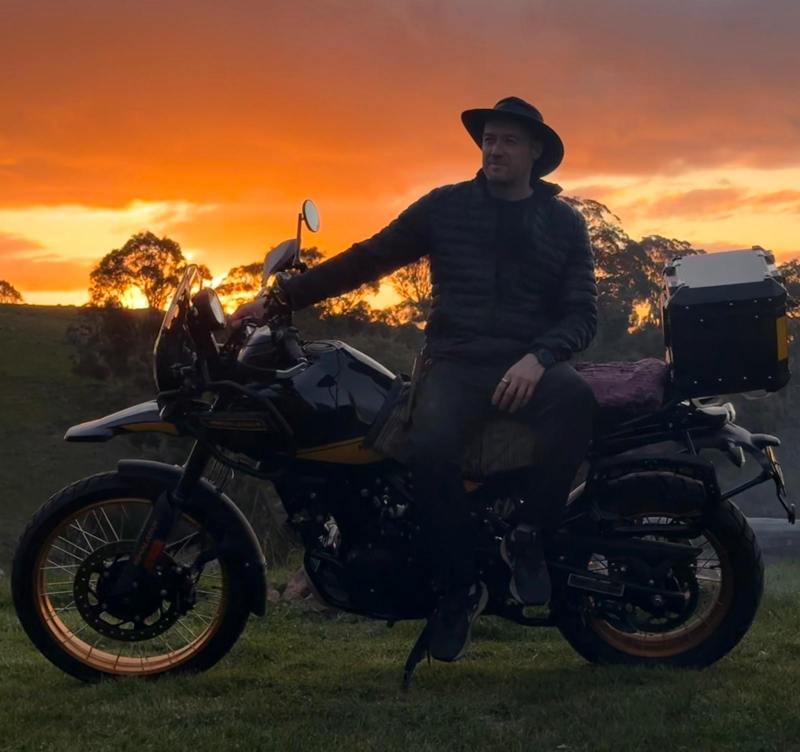
Standing at the lighthouse with a small bike parked behind you, the place earns its name.
The route, fuel stops, and accommodation
Distances (approximate):
Pahi → Dargaville: 60 km, sealed, ~1 hr.
Dargaville → Waipoua Forest (Tane Mahuta): 60 km, sealed, ~1 hr.
Waipoua → Kaitaia: 130 km, sealed, ~2 hrs.
Kaitaia → Tapotupotu Bay: 100 km, sealed, ~1.5 hrs.
Tapotupotu → Cape Reinga: 20 km, sealed, ~25 min.
Total day one: ~370 km. Total day two (eastern return): ~420 km. Round trip: ~640 km.
Fuel stops: Dargaville (BP, full service), Opononi (small but reliable), Kaitaia (multiple, cheapest in the north). After Kaitaia there are no fuel stops until you return south. A 17-litre Himalayan tank doing 28 km/L (real-world loaded) gives 476 km of range on a full tank — comfortably enough for the Kaitaia-Cape-Kaitaia leg with reserve.
Accommodation: Tapotupotu DOC campsite is the best option for adventure riders. Rarawa Beach DOC campsite (35 km south of the Cape) is the alternative, less crowded but further from the lighthouse. Whatuwhiwhi TOP 10 north of Kaitaia is the paid option with hot showers and laundry; useful as a base for two-night stays or for riders who want comfort over wilderness.
What to bring on a Himalayan
For a two-day version of this trip, what I packed earned its keep:
Tent (one-person, three-season). Sleeping bag good to 5°C. Therm-a-Rest pad. Single-burner stove and a small pan. Water filter. Two litres of water on the bike, another in the Kriega R30. Two days of food (oats, instant coffee, two dehydrated meals, one chocolate bar). One change of base layers. Wet-weather kit. Headtorch. Tools and a tube. The Garmin InReach Mini 2 clipped to the strap. The Zumo XT2 on the bars; offline maps loaded for the whole route before leaving home.
I did not bring a chair. I should have. The Tapotupotu fire was better with somewhere to sit; the rocks I borrowed were cold by the second hour.
What to know before you go
Cell coverage drops out between Kaitaia and the Cape. Vodafone is the most reliable; Spark and 2degrees both go silent at points. The InReach covered the gaps; without one, tell someone your route and arrival time before you leave Kaitaia.
The road is sealed but not flat. The 1F between Kaitaia and the Cape runs through small undulating hills with corner camber that occasionally tightens unexpectedly. I had a moment going down a hill at 90 where I had read a corner as gentler than it was; trail-braking out of it was the right call. Pay attention; the road has weather and the weather has corners.
The wind at the Cape is real. On a still day it’s thirty-five kilometres an hour. On a normal day, fifty. On a bad day, eighty. The bike parked at the carpark is fine on its centre stand; the bike on its side stand will fall over. I left Hunter pointing into the wind on the centre stand with the front wheel locked; came back to find him unmoved, the seat dry, the panniers a little gritty with sand.
You are not alone, but you are alone enough.In autumn there were maybe twenty other vehicles on the road north of Kaitaia. Three motorcycles. Most were grey-nomad campervans. The Cape carpark held four vehicles when I arrived. Summer would be busier. Autumn was right.
If you want to go further
The natural extension is a four-day version that includes the Ninety Mile Beach detour (which you cannot ride a bike on — it’s a 4WD-only tidal route) by going around it via SH1 and then picking up the East Cape on the way home. That version is closer to 1,200 km total and involves a second night somewhere around Hokianga or Russell. I have not done it yet. Probably late winter 2026, with the carnet still valid.
The bigger extension — Pahi to Cape Reinga to Bluff (the southernmost point of New Zealand) — is a project for another year. Hunter has the range. I have the time. The carnet, alas, expires in January 2027, which means a permanent import or a re-export decision before that route is on the table. Decision pending.
What’s next
Two more Northland route guides are coming — a Kaipara Harbour loop suitable for a day ride from Pahi, and a Coromandel Peninsula run that picks up where the Coromandel drop left off. The local SEO opportunity here is real and under-served; if you found this piece looking for practical Northland riding information, the next two should land within the week.
In the meantime: if you have been thinking about riding to the Cape and looking online for honest practical information, this is the version with numbers. Two days. Six hundred and forty kilometres. The wind takes your hat at the lighthouse. The kettle is warm again by the second night. The country earns its name.
Get the next one
Twice a month. Photographs, a reflection, where I’m headed next.